When I first started to think about this assignment I initially rejected the idea of doing anything with maps as unhelpful given the nature of the journey I wanted to depict. Whilst that view has not changed I have nevertheless come back to the role of maps, not as an inspiration or means of arriving at the subject matter for the project, but more as an outcome of the project, as an artefact that is itself the result of working through the assignment.
This has largely been the result of reading an article on the Magnum website about the work of Alec Soth who produced maps, not in order to make his various books, but as a result of having done so. Soth is of course one of the artists that I referred to earlier in connection with photographic depictions of journeys, though explicitly not one who influenced my thinking or choice of subject matter in this case.
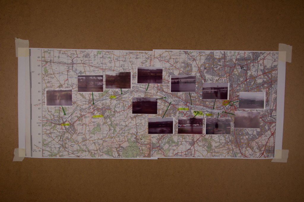
What I have done for this is scan an OS map that shows the route between where I live and the city of Newcastle, blown it up, and reprint it. Onto this new copy I have put thumbnails of the images I have chosen for the final set, indicating where on the map they relate to.
As it happens this is the only OS map that I have that covers all of this area and it turns out it is thoroughly out of date, going back to 1971! Most significantly what has changed in the interim, for the purposes of this project, is the line of the railway itself, though that is admittedly hard to see in the photo below. It now runs along the south side of the river as far as Gateshead and then crosses the river over the second up-stream bridge marked on the map into Newcastle. Back in 1971 the line crossed the river at Blaydon and ran along the north side of the river, following the route of an otherwise long disused line that ran along that side from Wylam, where there is still a very fine bridge that now serves only pedestrians and cyclists. (There are plenty of other differences, such as the absence of the current dual-carriageway version of the A69, and of the Metro Centre, which has its own dedicated train station. These are though not really relevant for the purposes of this assignment and would really only mean something to anyone who knows the area now.) I like this map though because it has a distinctive style that the OS no longer uses which is much sharper than the modern versions.