Category: Assignment 2

Assignment 2 – At last the book is finished!

At long last the book is finished.  It seems to have taken an inordinate amount of time, but I have to recognise that my studio has been out of action for quite a while and a number of other commitments have intervened.  Nevertheless, it has taken much longer than I anticipated, not least because I underestimated how much work is actually involved in making a book of this nature; not surprising, perhaps, because I have never before made anything quite like this.

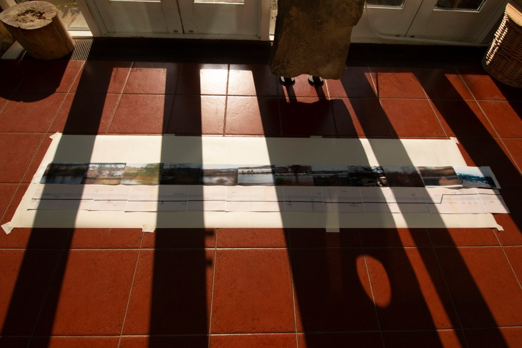
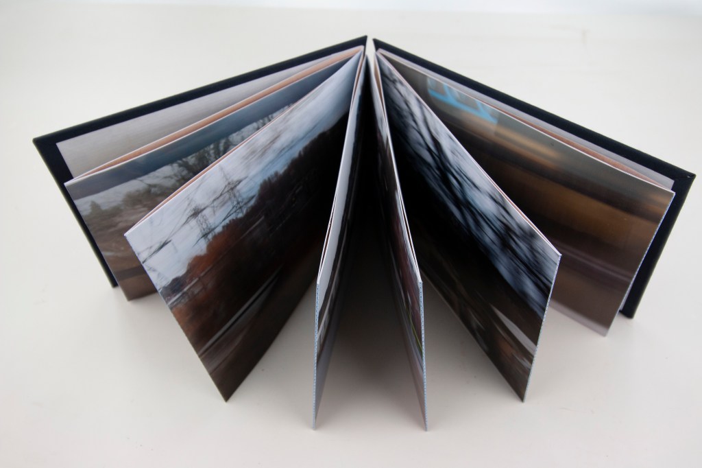
Nevertheless, it is now done, and as a first attempt at such a project I have to say I am pretty pleased with it.  It is not perfect and is still, as I anticipated, very much a mock-up, a maquette, but nevertheless I think it looks good.  It is on the one hand quite a solid piece of work, not least because in part it is three layers thick – photographs, hinges, map backing – but on the other feels a bit fragile.  Possibly this is simply because of its hand-made nature and the fact it is, so to say, a prototype, lacking in a certain professional finish.

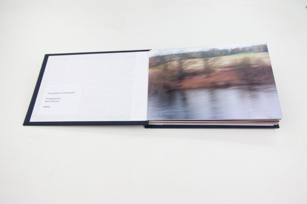
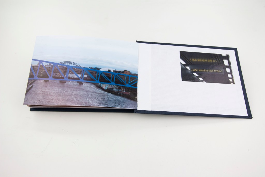
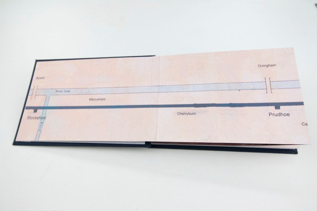
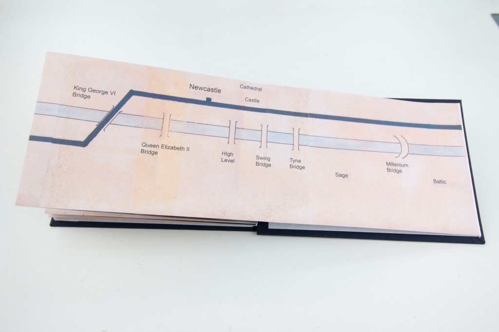
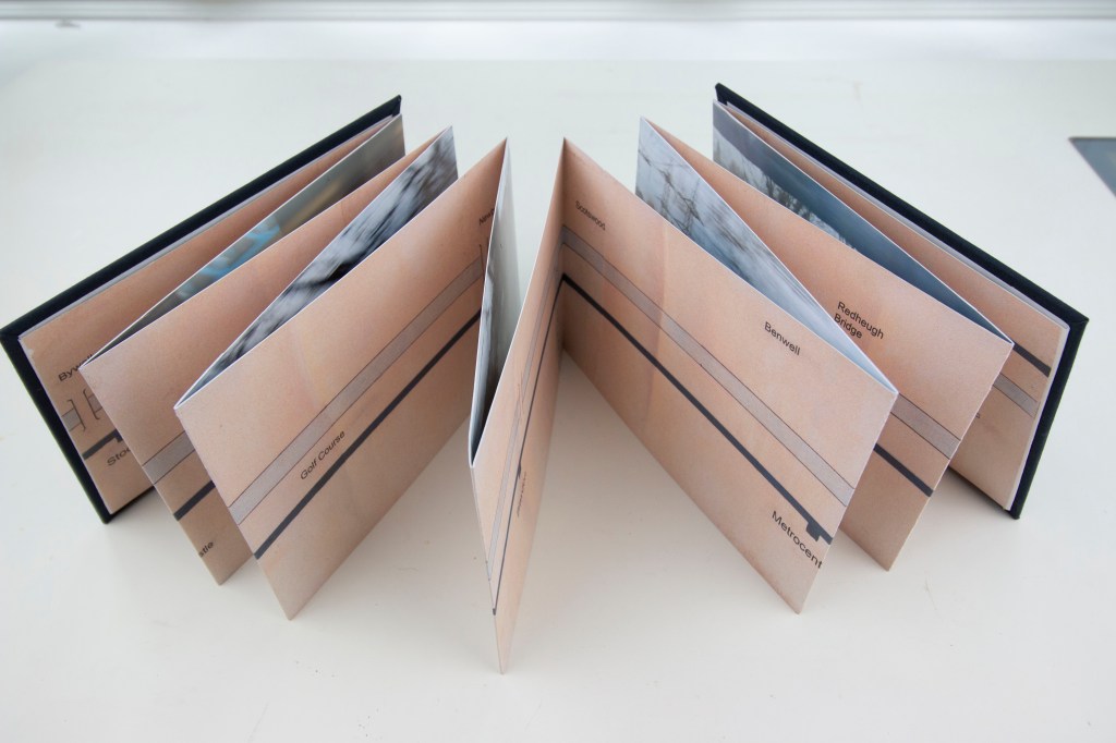
A bit of technical background on its construction.  The photographs are digital prints on Canon Pro Platinum paper, hinged together with strips of envelope (a bit more robust than the other papers I have available).  The map sections (prints of a scanned, hand-drawn map) are on ordinary plain printer paper and overlap the joins of the photographs, reinforcing the hinges.  The covers are cut from some fibre board that I happened to have lying around in the studio – just the right weight and thickness – and covered with a smooth finish rayon dark blue bookcloth   These are in turn lined with a white ribbed kraft paper.  Everything was stuck together with a rice starch and PVA paste, which has the advantage of being slow drying, so that everything could be adjusted and aligned properly before going into the press, dries without staining, and smooths out any folds or creases in paper.  As each step of the construction was completed the growing book went into an old cast-iron bookbinder’s press (which is incredibly heavy!) to keep everything flat while the paste set.  (Despite this there is a clear tendency for the photos to curl slightly so it is clear that over time it is going to be necessary to keep the book firmly closed to keep the contents flat.)  I have added a small colophon plate to the inside of the front cover and an extra photo, not part of the original sequence for this assignment and on a smaller scale, by way of a coda onside the back.

The specialist bookbinding materials (bookcloth, paste, a couple of tools) I bought from Shepherds in London, a Mecca for bookbinders.  I have not visited their shop but I expect it will be an Aladdin’s cave!  (My favourite such shop of all is probably Cornelissen near the British Museum, that dates back to 1855, from which I have in the past bought much of my print-making materials.)  

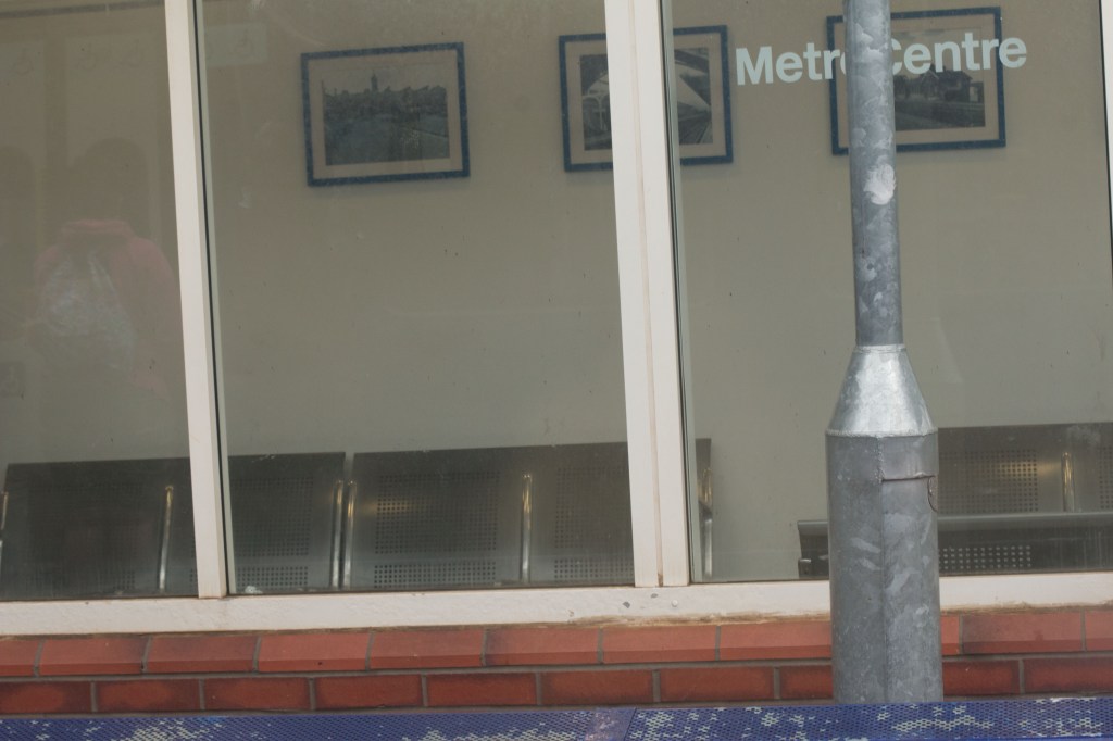
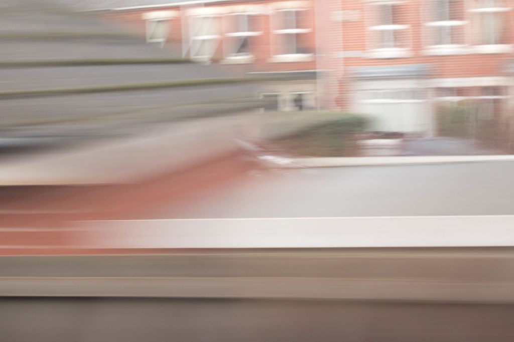
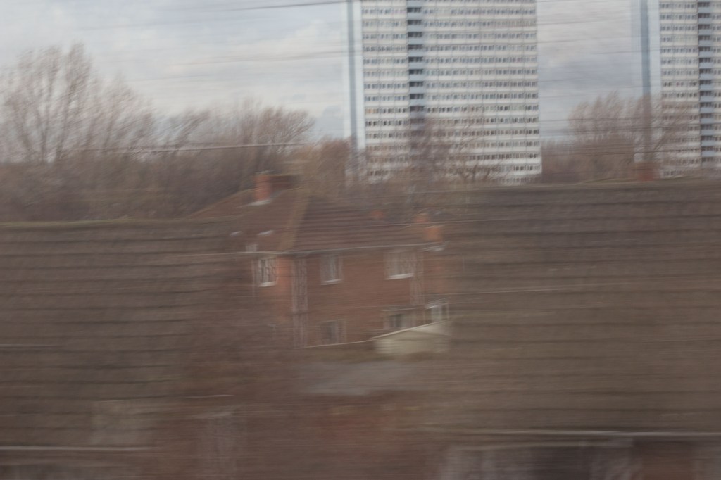
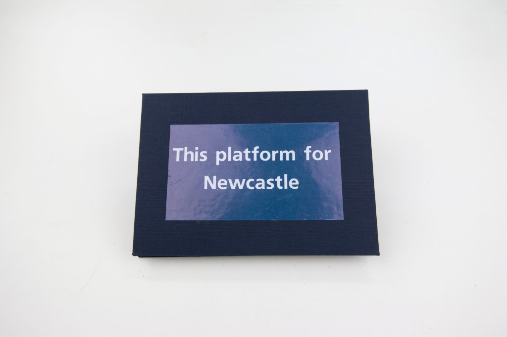
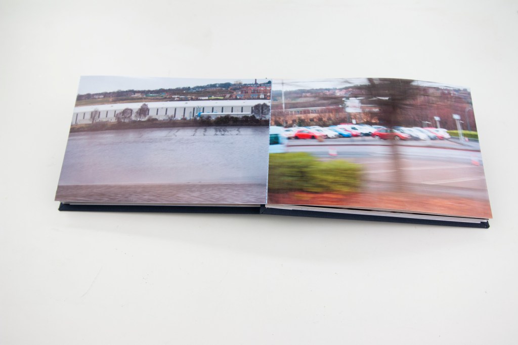
Here are some views of the finished article:

And a short video to give some further sense of the physicality of the book as an artefact:

It could be said that, in a sense, this has been a bit of a distraction in that I did not need to make this book.  Nevertheless, I feel it has been a very useful, and enlightening, not to mention valuable, diversion.  I have learned so much about the physical process of producing a book (at least one in concertina form) that I am sure is going to be valuable in the future and open up more possibilities worthy of consideration for the presentation of work.  It has also itself, as a physical process, simply been enjoyable and satisfying and worth doing from that point of view alone.

Assignment 2 – Progress with the book!

I have now got my studio functioning again and have made some progress with this long running book project at last, though paradoxically I have had to move everything into another room to do so.

Having got the sequence of photographs sorted and hinged together, the next job, having drawn and printed the map to go on the reverse, has been to arrange the sections of the map to match the overall length of the whole sequence.  This has proved to be much trickier than I had anticipated and has involved a certain amount of “editing” of the map.  Fortunately, the map has never been strictly to scale, for practical reasons that I have already touched on, and all the more fortunately there are stretches of it that contain very little, and so are ripe for cropping without upsetting the overall scheme.  From a practical point of view though it has not been possible to do a proper layout in the studio, because my working table is simply not big enough to accommodate the whole length of the nascent book (almost 2.5 metres, a good metre longer than my drawing desk) which has made synchronising photos and map sections difficult.  This is a crucial task that needs to be got right before I can start to fit the concertina within the book covers.  I have therefore had to resort to laying the whole thing out on the floor in my garden room, the only other practical space reasonably available.  This is not the greatest of photographs because of the bright westerly sun but nevertheless shows how I have been able to lay out the ready prepared concertina sequence of photographs and arrange the map sections to match.

Since then I have pasted the map section onto the back of the photographs and now the whole thing has been refolded and is in my book-press to compress and flatten everything out.  The next step will be to mount the cover boards (which are otherwise ready), add an internal lining paper to them, one final image on the inside of the rear cover to round off the main sequence, a small colophon plate that will go on the inside of the front cover, and at last all will be done!  All being well, that will all happen within the next couple of days and after a little more time in the press to make sure everything is flat, it will at last be complete.

Assignment 2 – Still working on the book!

Since I last wrote about this book project, which now seems to have taken on a life of its own, consuming mine in the process, I have been able to make some more progress and to discuss it with my tutor when we discussed my submission for Assignment 4 (I will post on that separately once we have finalised the feedback).  I had made a mock-up of the map (2.25 metres long!) which he quite liked.  I have since gone on and created a jpeg version of it, which has allowed me to add type for the stations and other points of note along the route instead of having to write them on by hand, which I fear would have looked a bit too messy.

The prints of the photos have now been made and trimmed to size and I am in the process of adding hinges between them.  Once that has been done, I will print and trim to match the sections of the map, then add the covers. Still lots of work to do and I still expect that the result is going to be a maquette from which a final version might, theoretically, be produced professionally, rather than an “artist’s book” in its own right.

On that last note, quite coincidentally there are a couple of brief articles in the latest edition of Printmaking Today (pp 22-23) relating to artists’ concertina form books.  (I am not actively making etchings or other prints of my own at the moment, being all-consumed in my spare time by this course, but I still occasionally collect prints so like to keep abreast of what is going on in the wider print world.)  I am not entirely sure whether it is reassuring, but at least I am not alone with my struggles, but both show how difficult, and time-consuming a process making such a book is.

With a bit of luck, and not a small amount of further effort, I should be finished soon!

Printmaking Today.  Summer 2020.  Vol.29, Issue 114

Assignment 2 – More thoughts on the book and its map

Although I have to produce the physical book for this assignment (I am currently awaiting some book binding materials and tools that will be helpful) I have been giving more thought to how I deal with the map that is to go on the reverse of the photos.

The original intention was to make this up from an Ordnance Survey map.  While working on the dimensions of the book (I am intending the images to be A5) it quickly became apparent that this is not going to work.  The problem is largely one of scale.  The ratio of the physical length of the series of photos to their height is 17:1.  Looking at the map though the ratio from the start point to the end is more like 17:3; the distance between the start and finish points, a straight line from west to east, is about 17 miles but the distance between the southernmost point on the route, the start point at Stocksfield, and the northernmost point, Clara Vale roughly half way between Wylam and Blaydon, is three miles.  The numbers simply do not fit the format of the book!  I have looked at a number of other possibilities but none of them work particularly well.  One is simply to distort the map to straighten out the train line.  This just looks odd.  Another is to make a sort of mosaic made up of twelve panels that each show a section of the line and fit the 17:1 ratio.  This though looks very disjointed and does not give a sense of the continuous journey.

I have therefore been looking at a more schematic approach and have been confirmed in my thoughts that this should be better by looking again at the two books I have mentioned in connection with Exercise 5.5.  I have been thinking along the lines of train network and route maps (think the London Underground map) that do not contain any reliable geographical information but merely show which station is followed by which when travelling along the line.  Northern Railway, our local train company, have a very simple, purely linear, schematic map showing the stations along the line.  This I think can form the basis for the book’s map, but to make it more interesting, and tie it more closely to the geographical realities of the journey, I intend to include, at the appropriate points in relation to the stations, some of the places of interest along the way, that are either referred to in the photographs, or are otherwise of local significance.  Not least it needs to give an indication of the river and of the bridges over it.  I am currently playing around with a few ideas but at the moment I think this is going to have to be hand drawn, at least for the purposes of this initial mock-up.  Depending on how well that comes out, it might of course be necessary to come up with something more refined if the book was ever to be produced as something more than an experiment.  More on this anon.

Molitor, C, (2015).  Sonorama.  Listening to the view from the train.  Axminster:  Uniformbooks

Stenger, S, (2014).  Sound Strata of Coastal Northumberland.  Newcastle:  AV Festival

Exercise 5.5: Create a slideshow – 2

Last night while cooking dinner, and listening to Mozart sonatas for piano and violin, (not so irrelevant perhaps, as it meant that I was not actively thinking about this coursework) I had some more thoughts about the book project for Assignment 2 and the slideshow experiment for this exercise.  In particular there came to mind two books that I had not thought out before in connection with any of this work but that are in fact helpful to what I am doing now, Molitor (2015) and Stenger (2014).  

Neither of these involve photography but they do have linked visual and audio elements.  Claudia Molitor’s work, which can still be experienced on her website cited below, is an audio representation of a journey by train from London to Margate, the sounds, songs, music, and words, representing places along the way, accompanying a schematic, hand-drawn map of the journey.  Susan Stenger’s work was an installation based around a geological cross-sectional map of the coast of Northumberland, from the mouth of the Tyne to the Tweed at Berwick, made in 1839 by Nicholas Wood, some 12.5 metres long.  The map was accompanied by a soundtrack, mostly made up of fragments of folk tunes associated with places along the route, lasting about an hour.  The idea was that you walked along the map, listening to the fragments at the relevant points along the way.

These two works set off an idea for developing the work I did for Assignment 2 as a possible alternative to the book.  When I originally did that work, I did not think that a slideshow would work well, particularly with the limited set that will form the book.  I also did not have a good grasp on creating a slideshow.  Now that I have done a couple of experiments for this exercise, and having played around a bit more with Lightroom, which has proved easier than I thought, notwithstanding a couple of false starts, I think that something could be done.  To work properly though it needs to be much more substantial and include many more of the shots that I took along the route.  Indeed, I have for now settled on about 108, making a slideshow that lasts almost 12 minutes.  In an ideal world I think it would be interesting to make the slideshow last as long as the journey itself, about 25 minutes, to make a much more immersive experience.  I have posted this initial trial set on Vimeo.

Bearing in mind the work of Molitor and Stenger, what the slideshow needs is a soundtrack to accompany it.  Realistically I do not think this is easily achievable now, for the purposes of this exercise, and would be quite a major project in its own right, not least if the whole piece was to last the equivalent time of the train trip.  There are also issues with regard to licensing, and presumably royalties, for some of the music that would be useful in a project such as this.  Nevertheless, here are some ideas for music and sounds that might work:

The start of Richard Rodney Bennett’s theme music for “Murder on the Orient Express”

Extracts from Arthur Honegger’s “Pacific 231”

The sound of migrating geese for the ponds at Merryshield

“Rocket Man” for Wylam where George Stephenson’s cottage is (an unforgivable but irresistible pun)

The sound of golfers for Ryton golf course

“Blaydon Races” (for Blaydon, obviously!)

The sound of cash registers from Pink Floyd’s “Money” (Dark Side of the Moon) for the Metro Centre

Iron foundry/heavy industrial noises for the Armstrong works at Scotswood

Pons Aelius “Fire under the Bridge”

Lindisfarne “Fog on the Tyne”

I am sure there are plenty of other sounds and tunes that could also be incorporated, particularly folk tunes that have specific local connections, but it is going to take quite a lot more work to identify them and bring them together.  For now, just let this be a mental exercise.

Molitor, C, (2015).  Sonorama.  Listening to the view from the train.  Axminster:  Uniformbooks

Stenger, S, (2014).  Sound Strata of Coastal Northumberland.  Newcastle:  AV Festival

http://www.claudiamolitor.org/sonorama-1/

Assignment 2 – Further Research and Tutor Feedback

I have been so busy of late working on Part 3 generally and on Assignment 3 in particular that I have not until now got round to following up a link provided by my tutor in response to the work I did for Assignment 2. I have now remedied that oversight.

He pointed me in the direction of a short video clip, which is in fact a series of still photos, made by Chris Killip in the Japanese fishing town of Kesennuma shortly after the earthquake and tsunami struck in 2011, and some months later showing some of the clean up and start of recovery. Killip (for whom I have a lot of time, not least simply because of his connections with the North East) took photos every twenty paces along a particular street. This is an approach similar to the one I used, but of which I had not previously been aware, on my train journey, setting the camera to fire every ten seconds. In both our cases the resulting image is not the direct result of a conscious decision but of the operation of a pre-determined process, so the results are almost, but not quite, random.

The resulting work is very moving in its simplicity.

Coincidentally I have just started to read (or is it that I have just been prompted, reminded, to look at this video because I have just done so) Richard Lloyd Parry’s book (2017) about the tsunami. As is not uncommonly the case with my reading, this book has sat on my shelf for a couple of years before I have got round to reading it in earnest. Sometimes books just have to wait until the time is right for them, and more often than not I do not consciously know when that time is until I finally get my nose into it. Kesennuma, the town visited by Killip, is mentioned a few times. Even for Japanese people it is, or was, hardly known; it is not a part of Japan that I know at all – I really only know some of the the area between Tokyo and Kyoto, and the mountains above Nara overlooking the Inland Sea. It is poignant that it should become known now to a wider (but I guess still a fairly narrowly interested public) audience as a result of this tragedy. It also appears on one of the maps in Gretel Ehrlich’s book (2013) (which in contrast I read immediately it came out) but I do not recall that she visited, although she did spend some time nearby: she is more concerned with the people affected by the disaster than with specific locations (places such as Sendai and Fukushima apart – for obvious reasons).

Ehrlich, G, (2013). Facing the Wave: A Journey in the Wake of the Tsunami. New York: Pantheon

Lloyd Parry, R, (2017).  Ghosts of the Tsunami.  London:  Jonathan Cape

https://vimeo.com/42778555

Assignment 2 – Tutor Feedback

I had a very useful discussion with my tutor the other day in response to my submission for Assignment 2, which I am very pleased to report he liked! For ease, below is what he wrote in his formal report, that also covers a number of other issues:

Overall Comments

We discussed issues relating to the course in general; a perceived (in)balance between theory and practice (something I will raise at the next tutor meeting) and assessment procedure. One particularly interesting observation/revelation you talked about was an increasing sense of politicization relating to matters of Landscape; such a contrast to the classical and modern approaches to work in the genre.

This is a detailed and highly informed submission, clearly documented in the Learning Log from initial ideas to the final set, with an alternative version and two potential modes of presentation – slideshow and concertina artefact printed on both sides.

Feedback on assignment 

The submission is a strong conceptual work based on deep research and knowledge of extant work and practitioners.

Clear evidence of research into practice and an independent take on the brief which explored not only the idea of the ‘journey’, but also an alternative aesthetic, one antithetical to the conventional (picturesque) idea of landscape.  

There is always a danger of allowing a concept to determine the final work rather than having a high level of control over the choice of subject matter, and this can be a problem when engaging the viewer.  However, this set works well with the aims fully realized in a set of ‘randomly’ generated images documenting a train journey, with no post-production work or correction.  The set captures a real sense of the tedium of a repeated journey from the passenger‘s perspective as well as a sense of the physical limitations and possible perceptions of the landscape – snatches of rural and urban life flattened by the parallax depth of field, motion blur and muted seasonal colour and contrast.  This produces some genuinely intriguing images, a fleeting sense of the world around us and the limited grasp and understanding we can have; also, the form of the landscape, often blurred and smeared across the frame and textures, in the river, for example, an accidental byproduct of the process. 

We discussed the possibilities of exhibiting this type of work, with a slideshow as one option, or a printed concertina artefact similar to the work of Zoe Childerley’s work ‘Debatable Lands’.

Finally, what impresses is the amount of work – research and practice – that went into this project and importantly a sense of continuity of approach from Assignment 1.

Coursework

Demonstration of technical and Visual Skills, Demonstration of Creativity 

Detailed response to projects and exercises throughout.

Research

Context, reflective thinking, critical thinking, analysis  

The research and reflection carried out for this assignment, (mostly) independent and  exploratory, is highly focused and aligns itself to a contemporary contextual framework: from the Land Art of Christo, Long and Nash to recent exemplars by Kazuma Obara and Craig Mod (Kumano Kodo). You draw upon a range of sources and demonstrate a real knowledge and literacy of the medium in this genre.  Importantly, the continuing nature of the research over time running in parallel with the development of the assignment allows you to maintain a critical awareness of your own practice.  The final research note is about Ravilious’ ‘Train Landscape from 1940, with a quote that (I agree) clearly reflects your own aims:

‘We imagine ourselves, by an odd transference, as seated in a stationary interior with the world rushing past outside …”

Learning Log

We didn’t touch on the LL, but I can see that you’ve updated the pages with an article about the recent offerings at the Side Gallery and the ‘One Billion Journeys’ showcasing Wang Fuchun’s work  – interesting parallel to the Provoke group, and of course how this feeds into the development of your A2. 

Three detailed posts uploaded under your Notes tab on Postcards, (the usefulness of) Theory into Practice.  ‘When I am out taking pictures there is no room in my bag for books on theory!’ ,  a lot of practitioners would agree

The piece on filters (for analogue) was particularly interesting, I did a lot of work on ‘day for night’ cinematography in the 70s. Using the conversion tools in PS can produce a range of results and totally different moods in monochrome; I find them most effective with a considerable degree of control.

Suggested reading/viewing 

Tsunami Sidewalk by Chris Steele Perkins

 HYPERLINK “https://vimeo.com/42778555” https://vimeo.com/42778555

Pointers for the next assignment / assessment

We discussed the development of A3 and you are exploring ideas around Memorial benches and the landscape views they offer.  I can see a continuity of theme from A1 and 2 here in the sometimes random or mundane views these benches offer: who determines where they are sited, the doner, charity or local authority (?) 

We also discussed developments for Assignment 6 and the regular captures you have made for the ‘Ford’ project – all going well.”

All very gratifying and encouraging. At last I am beginning to think I am getting somewhere with this!

In the light of this feedback I do not really think that my submission for this Assignment necessarily requires any reworking. Nevertheless, having talked it through with my tutor, and having in particular reconsidered the alternative set that I produced, I do think there is a benefit in adding a couple of images from that other sequence to the primary set. In particular, there is something to be gained by adding the shot of the passing train, the tenth image in that series. Passing other trains, particularly on the bridge, is a common feature of this journey. Visually I also think it adds something in so far as there is the glimpse of the train, the Metro bridge (the blue one) just visible in the background through the windows of the other train, and a reflection of my train.

In addition, as I intend to follow up with the book idea (on which more anon) there are two images that might be used on its cover, that is the first and last of that other sequence. The first effectively gives a title to the set as a whole, and therefore to the book, and would be useful on the front cover. The last one gives a sense of the completion of the journey and so might usefully appear, perhaps just as a quite small print, on the back cover. The next step is to gets some prints made and start mocking up the book!

I will do a separate post next with the full, revised sequence.

Similarly I will write something more once I have had a chance to look at the Chris Steele Perkins video. (There is of course a local connection in so far as he spent a lot of time here in the North East and I wrote about his The Last Ships exhibition on my I&P blog: https://markrobinsonocablog3ip.wordpress.com/2018/09/26/the-last-ships-exhibition/)

Assignment 2: Presentation

Whilst I will probably only finalise the set for this assignment once I have had feedback from my tutor I have nevertheless in the meantime been giving some thought to how that set might be presented when the time comes for assessment.

For the last assignment of I&P I toyed with the idea of making a form of concertina book. Eventually I rejected the idea as it did not really present the message that I wanted to get across, and my then tutor was a little cautious from a technical point of view, such a thing not necessarily being easy to pull off. Ironically I understand that the assessors were quite keen on the idea! For the present project though I think it would be ideal.

I do have a precedent in mind in the form of Zoe Childerley’s book (2016) which she made at a time that I was helping out at VARC. From her experience I know that it was technically quite a difficult book to produce (the first production run had all of the photos in reverse order!) but the final version works really well, with the sequence of images on one side and a map of the route that Zoe walked on the reverse.

Something like that should work well here, though instead of a hand-drawn map I would propose to make up a strip from an up-to-date OS map. Subject to looking into the practicalities, I doubt whether it would be feasible, practically and financially, to have a book made up professionally. I know that there various companies out there that will make bespoke photo-books but I am not sure about something in quite this physical form. It should though be possible to make a reasonable hand-made example that will at least adequately illustrate the principle.

Childerley, Z, (2016) The Debatable Lands.  High Green: VARC

http://www.zoechilderley.co.uk/the-debatable-lands-book/4593164515

Assignment 2: Alternative Final Set

Having started to think about the strengths and weaknesses of the first final set that I have chosen, as discussed in my last post, and about other ways in which this project might be presented, I have come up with another set.

The last set was very much based on the visual experience of being on the train and experiencing the journey through the window, observing the landscape as the train passed through it. For an alternative approach I have put together a more varied set describing the journey itself, from boarding the train to getting off, as a more abstract experience. A number of images have been carried over from the previous set. Some have come from the attempt at a text based set. I have though added a few new ones from the first shoot. Again, I have tried to highlight the contrast between country and town, this time adding a bit more emphasis on the build up of residential areas as the train comes into town. I have also hinted at the presence of other train traffic as one approaches Newcastle: the ante-penultimate image is of another train crossing the King Edward VII bridge into Newcastle.

Whether this is better I am not sure. It is at least more varied from a visual point of view. I can see an almost infinite number of possible combinations of the pictures that I took for this project but this one will do for now and at least I think it works.